
July 14, 2011
Quebec City to Fredericton New Brunswick
We departed Quebec City mid morning and immediately had a disagreement with Jodi. Jodi is the name we’ve given to our G.P.S. She (Jodi) was taking us out of town in a very round-about manner. We knew this city like the back of our hand after walking it for the last two days. We had expected to head out of the city the way we had come in, but Jodi had other ideas. She took us through the gates into Old Quebec City and along the twisting streets all the way to the bottom of the lower city that paralleled the St. Lawrence. Next, she had us turn into a ferry terminal that we had seen from the cliffs high above the day before. The ferry shuttles commuters and tourists across the river and apparently would cut down our driving time because we wouldn’t need to retrace our steps.
As it turned out, Jodi had made the correct decision for us. The ride across was short, but we still had an opportunity to go up on the upper deck to view the city from a different perspective. Once docked, we climbed up the opposite bank using a system of switchback turns, rejoined the TransCanada, and headed northeast to New Brunswick. Our route paralleled the St. Lawrence and passed through a large dairy-farming region. Eventually, we left Quebec and entered New Brunswick. Rolling farmland and forested areas dominated the landscape all the way to Fredericton. After battling street lights (13 red in a row), we arrived at the information center. The idea of synchronized lights definitely hasn’t reached NB yet! Stopped in the information center and then went to view the Legislature Buildings and older sections of the city. Was a bit disappointed in the city itself. There was construction all around the government buildings so we were unable to get very close.
Drove about 45 minutes northwest of the city to a provincial campground called Mactaquac. Another nice drive through farmland and wood lots. Prior to our arrival, it had been very wet in New Brunswick. The Forest Fire Warning indicator sign was so extremely low that kids were allowed to play with matches. Our campsite was in a heavily forested area. The gravel site was rutted throughout due to the torrents of water that had flowed through over the past few days. I had a restless night due to an uncomfortable sleeping pad and a flashlight that kept shining in my eyes every time Hannah turned a page. She is on her fourth book in ten days. Apparently this is the best one yet.
July 15, 2011 Fredericton to Bay of Fundy National Park
We left camp around 8:30 and promptly got lost, (didn’t listen to Jodi) and then got found (listened to Jodi). Stopped for gas and went to Wal-Mart to replenish our supplies. Drove Highway 2 until we were compelled to stop for ice cream. The sign said, “McCabe’s World Greatest Ice Cream!” We decided to check it out. It wasn’t hard to decide what flavour to have as McCabe’s only had 6. To be fair, they were all made with all-natural ingredients and were delicious. Hannah and I had a serious discussion about the power of advertising.
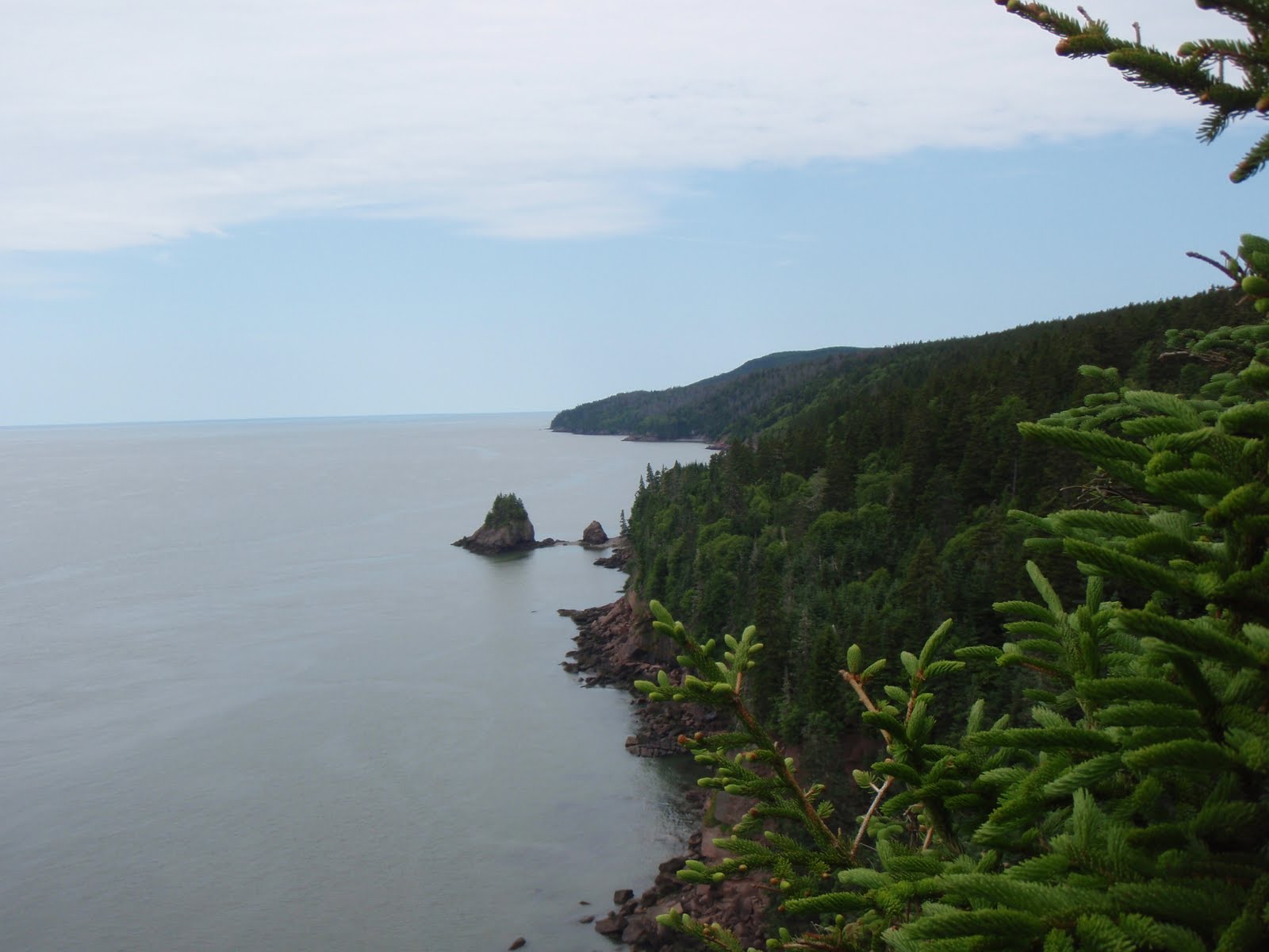
Switched to Highway 1 for the remainder of the drive to Fundy. This particular road should not be called a highway. There were more potholes and patches than original sections of highway. We drove for sixty km through thick forest without seeing any signs of civilization. Finally we crested a hill and caught our first glimpse of the Bay of Fundy.

Stopped at Wolf Point Campground and had a serious discussion about the state of New Brunswick roads with a park warden. The main TransCanada highway is fantastic, one might even say Autobahn like, but the remaining roadways are horrific. My warden friend told me that the reason for the poor roads is that New Brunswick is a relatively poor province and most traffic never leaves the main highway. He suggested their license plate motto should be New Brunswick – The Drive Through Province. It was hard to argue with him.
Our campsite was in a secluded little spot that had apparently already been staked out by a family (read gang) of aggressive chipmunks. They made themselves at home in our boxes of supplies and even in the hatch of the car. We walked down to Wolf Point Beach by following a weathered old boardwalk and descending 150 steps. Hannah counted them. The tide was almost completely out and it was amazing to see the high tide mark on the surrounding cliffs.


July 16, 2011 Bay of Fundy (Day 2)
After a delicious breakfast of toast, yogurt and juice we were set for some hiking. Thought about hiking up to Third Vault Falls, but neither of us had come prepared with footwear appropriate for the wet and muddy trail. We opted for a coastal hike from Wolf Point to Herring Cove. This 6 km trail wound its way through forest and over headlands and offered outstanding views of the Bay of Fundy and of Nova Scotia across the bay. It’s Parks Day today so there is free admittance to any of the national parks. We thought the trails would be packed toady, but we only met two other parties during our two and a half hour hike.


Later we drove into the town of Alma, which is about five minutes outside the park boundary. We had a bite to eat and picked up some ice and marshmallows. We stopped at a fish shop to inspect some lobsters. The larger of the specimens could be gotten for a measly 17 bucks! On our way back, we stopped at Dickinson Falls and walked a short interpretative trail down to the falls and then back along the cascading pools of the creek.


Back at camp, we took the opportunity to shower and get some of the bug juice off our bodies. Refreshed after showering, we quickly reapplied bug juice before organizing dinner. We were a bit surprised there were so few people in the park. Perhaps the recent cool and wet weather had dampened people’s interest in camping.
July 17, 2011
Today we drove the coastal highway towards Hopewell Rocks. Beautiful scenery accompanied us along the very windy and windy coastal road. Hannah only threw up once. Stopped at a viewpoint at Cape Rage and became entangled in a tourist trap. Fifteen dollars later we were viewing the Cape Rage lighthouse (built in 1840) and feeling a little full of rage ourselves for having to pay to take in the view.

We continued onto Hopewell Rocks and realized we had missed low tide by an hour. We were still able to walk along the beach and visit the iconic landmarks that make up the Hopewell rock formations. We stopped to take pictures in front of the Flowerpot Rocks and marveled at the amount of mud some of the children climbing past us on the stairs were carrying on their bodies from the beach. Hannah whispered, “So much for take only pictures and leave only footprints. Those kids are taking home half the beach.” The look on the children’s parents' faces told another story. They were wondering how they were going to get these filthy children into their vehicles. Tides here can fluctuate as much as 16 meters. During our time on the beach, it was possible to actually see the tide rising.


From Hopewell Rocks we traveled through Moncton and Sackville before arriving at an engineering marvel, The Confederation Bridge. We drove across the North Cumberland Strait to Prince Edward Island. The toll on the bridge was $44 return.

Prince Edward Island is known as the Green Province. I think they should be known as the Province of Large Lawns. The lawns are unbelievably expansive. Hannah was sure she could keep a horse well fed on any one of the beautifully manicured yards we passed.

We drove into Summerside and stopped for some groceries. The community was celebrating the last days of their Lobster Festival. Bunting and banners welcoming Kate and Will still hung over the main street. Reminders of the royal visit. We stopped and purchased some insurance in the form of a tarp and rope as we drove towards the national park under dark skies. The island is, in a word, pastoral. Fields of potatoes, strawberries, and hay grew in the dark, rich, red soil. Upon entering the national park, we drove along the coastal road stopping occasionally to walk across the dunes to the sandy red beaches. The lack of sun and blue sky made taking pictures challenging as there was little contrast between sky and water. P.E.I is an obvious favourite destination for touring motorcyclists. We encountered bikers from all parts of Canada and the U.S.


We stopped at Cavendish campsite in the park and found they had no room. “You don’t have a reservation?” asked the park employee. I wanted to tell her no. I wanted to tell her that we were on a quest to cross the nation and planning was not part of the plan. But by the way the woman was looking at me over her bifocals, I knew to keep my mouth shut and we moved on to Stanhope campground where we set up camp and prepared dinner quickly as rain showers followed us into the area. Our new tarp was useless as the trees were too far away to use so after a delicious dinner of pasta, salad and fresh P.E.I. strawberries we headed for the shelter of the tent.
July 18, 2011
After a dry night with only a few sporadic showers, we awoke to thunder and lightning, but no rain. We had a quick breakfast and struck down our campsite just before the monsoon hit. We drove into Charlottetown along a rutted secondary highway. Passing vehicles were literally throwing a wall of water over our vehicle as they sped by. Our poor windshield wipers could not keep up with the water. While we drove, we listened to “Spud FM.” The radio station kept our spirits up with their play list of summertime favourites.
On our way to Charlottetown, we passed the international airport. Hannah suggested abandoning the car and flying home. I considered her suggestion for a few moments and then drove on to the quaint city of Charlottetown. Beautiful old clapboard buildings, all brightly painted, dominated the downtown core. We visited Founder’s Hall and walked through an impressive multi-media presentation about the founding of Canada, starting with the first conference in Charlottetown, in 1864. B.C. should have held out for more than just a railway link!


Heavy rain was forecast to last another day, so we elected to make the rest of the day a travel day and drove out to Woods Island to catch a ferry to Caribou, Nova Scotia. Again, the overcast skies made photographing anything difficult. We did stop to take a picture of a few fish boats tied up and paid the price as mosquitoes swarmed me. I ran back to the car and Hannah reviewed the images I had just taken. “They’re blurry, Dad.” Out of the car I ran one more time. This time I endured the bites of the mosquitoes and held the camera as still as possible.


We arrived at the ferry terminal and awaited our boat through an impressive electrical storm that dumped several millimeters of rain on us. The entire seventy-five minute crossing was through low cloud so we didn’t see anything until we entered the Caribou harbour. Traveled up the TransCanada through Antigonish and Port Hawkesbury before stopping for the night in Nyanza, Nova Scotia. Nyanza is located at the bottom of the Cabot Trail. From here you can elect to go up the western or the eastern side of the trail. We took a hotel room to get out of the rain and do some laundry. The weather is forecasted to improve tomorrow.
The Hopewell Rock pictures bring back good memories of our trip. The tides are quite something!
ReplyDelete