Saturday, July 9, 2011

New Brunswick and P.E.I.


July 14, 2011

Quebec City to Fredericton New Brunswick


We departed Quebec City mid morning and immediately had a disagreement with Jodi. Jodi is the name we’ve given to our G.P.S. She (Jodi) was taking us out of town in a very round-about manner. We knew this city like the back of our hand after walking it for the last two days. We had expected to head out of the city the way we had come in, but Jodi had other ideas. She took us through the gates into Old Quebec City and along the twisting streets all the way to the bottom of the lower city that paralleled the St. Lawrence. Next, she had us turn into a ferry terminal that we had seen from the cliffs high above the day before. The ferry shuttles commuters and tourists across the river and apparently would cut down our driving time because we wouldn’t need to retrace our steps.

As it turned out, Jodi had made the correct decision for us. The ride across was short, but we still had an opportunity to go up on the upper deck to view the city from a different perspective. Once docked, we climbed up the opposite bank using a system of switchback turns, rejoined the TransCanada, and headed northeast to New Brunswick. Our route paralleled the St. Lawrence and passed through a large dairy-farming region. Eventually, we left Quebec and entered New Brunswick. Rolling farmland and forested areas dominated the landscape all the way to Fredericton. After battling street lights (13 red in a row), we arrived at the information center. The idea of synchronized lights definitely hasn’t reached NB yet! Stopped in the information center and then went to view the Legislature Buildings and older sections of the city. Was a bit disappointed in the city itself. There was construction all around the government buildings so we were unable to get very close.

Drove about 45 minutes northwest of the city to a provincial campground called Mactaquac. Another nice drive through farmland and wood lots. Prior to our arrival, it had been very wet in New Brunswick. The Forest Fire Warning indicator sign was so extremely low that kids were allowed to play with matches. Our campsite was in a heavily forested area. The gravel site was rutted throughout due to the torrents of water that had flowed through over the past few days. I had a restless night due to an uncomfortable sleeping pad and a flashlight that kept shining in my eyes every time Hannah turned a page. She is on her fourth book in ten days. Apparently this is the best one yet.


July 15, 2011 Fredericton to Bay of Fundy National Park


We left camp around 8:30 and promptly got lost, (didn’t listen to Jodi) and then got found (listened to Jodi). Stopped for gas and went to Wal-Mart to replenish our supplies. Drove Highway 2 until we were compelled to stop for ice cream. The sign said, “McCabe’s World Greatest Ice Cream!” We decided to check it out. It wasn’t hard to decide what flavour to have as McCabe’s only had 6. To be fair, they were all made with all-natural ingredients and were delicious. Hannah and I had a serious discussion about the power of advertising.

Switched to Highway 1 for the remainder of the drive to Fundy. This particular road should not be called a highway. There were more potholes and patches than original sections of highway. We drove for sixty km through thick forest without seeing any signs of civilization. Finally we crested a hill and caught our first glimpse of the Bay of Fundy.

Stopped at Wolf Point Campground and had a serious discussion about the state of New Brunswick roads with a park warden. The main TransCanada highway is fantastic, one might even say Autobahn like, but the remaining roadways are horrific. My warden friend told me that the reason for the poor roads is that New Brunswick is a relatively poor province and most traffic never leaves the main highway. He suggested their license plate motto should be New Brunswick – The Drive Through Province. It was hard to argue with him.


Our campsite was in a secluded little spot that had apparently already been staked out by a family (read gang) of aggressive chipmunks. They made themselves at home in our boxes of supplies and even in the hatch of the car. We walked down to Wolf Point Beach by following a weathered old boardwalk and descending 150 steps. Hannah counted them. The tide was almost completely out and it was amazing to see the high tide mark on the surrounding cliffs.


July 16, 2011 Bay of Fundy (Day 2)


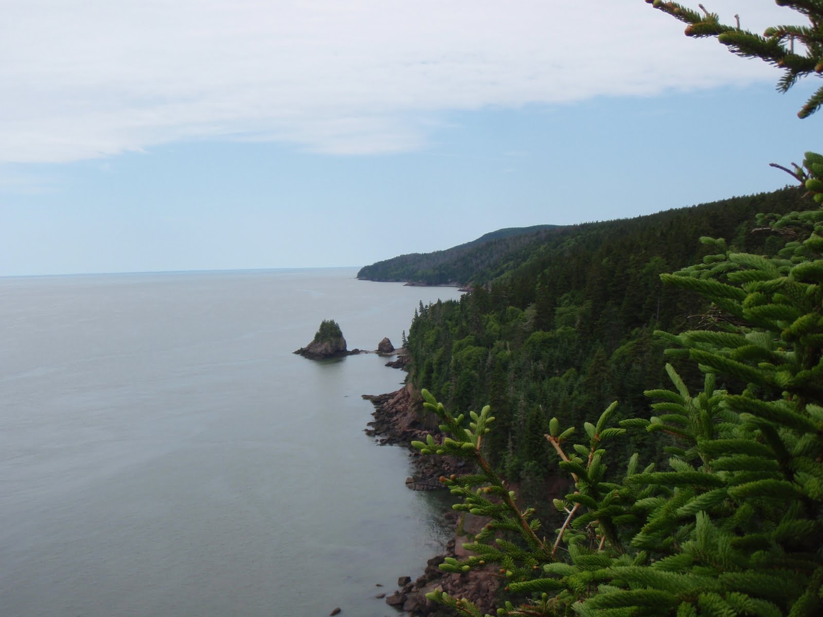
After a delicious breakfast of toast, yogurt and juice we were set for some hiking. Thought about hiking up to Third Vault Falls, but neither of us had come prepared with footwear appropriate for the wet and muddy trail. We opted for a coastal hike from Wolf Point to Herring Cove. This 6 km trail wound its way through forest and over headlands and offered outstanding views of the Bay of Fundy and of Nova Scotia across the bay. It’s Parks Day today so there is free admittance to any of the national parks. We thought the trails would be packed toady, but we only met two other parties during our two and a half hour hike.




Later we drove into the town of Alma, which is about five minutes outside the park boundary. We had a bite to eat and picked up some ice and marshmallows. We stopped at a fish shop to inspect some lobsters. The larger of the specimens could be gotten for a measly 17 bucks! On our way back, we stopped at Dickinson Falls and walked a short interpretative trail down to the falls and then back along the cascading pools of the creek.


Back at camp, we took the opportunity to shower and get some of the bug juice off our bodies. Refreshed after showering, we quickly reapplied bug juice before organizing dinner. We were a bit surprised there were so few people in the park. Perhaps the recent cool and wet weather had dampened people’s interest in camping.


July 17, 2011


Today we drove the coastal highway towards Hopewell Rocks. Beautiful scenery accompanied us along the very windy and windy coastal road. Hannah only threw up once. Stopped at a viewpoint at Cape Rage and became entangled in a tourist trap. Fifteen dollars later we were viewing the Cape Rage lighthouse (built in 1840) and feeling a little full of rage ourselves for having to pay to take in the view.


We continued onto Hopewell Rocks and realized we had missed low tide by an hour. We were still able to walk along the beach and visit the iconic landmarks that make up the Hopewell rock formations. We stopped to take pictures in front of the Flowerpot Rocks and marveled at the amount of mud some of the children climbing past us on the stairs were carrying on their bodies from the beach. Hannah whispered, “So much for take only pictures and leave only footprints. Those kids are taking home half the beach.” The look on the children’s parents' faces told another story. They were wondering how they were going to get these filthy children into their vehicles. Tides here can fluctuate as much as 16 meters. During our time on the beach, it was possible to actually see the tide rising.


From Hopewell Rocks we traveled through Moncton and Sackville before arriving at an engineering marvel, The Confederation Bridge. We drove across the North Cumberland Strait to Prince Edward Island. The toll on the bridge was $44 return.


Prince Edward Island is known as the Green Province. I think they should be known as the Province of Large Lawns. The lawns are unbelievably expansive. Hannah was sure she could keep a horse well fed on any one of the beautifully manicured yards we passed.


We drove into Summerside and stopped for some groceries. The community was celebrating the last days of their Lobster Festival. Bunting and banners welcoming Kate and Will still hung over the main street. Reminders of the royal visit. We stopped and purchased some insurance in the form of a tarp and rope as we drove towards the national park under dark skies. The island is, in a word, pastoral. Fields of potatoes, strawberries, and hay grew in the dark, rich, red soil. Upon entering the national park, we drove along the coastal road stopping occasionally to walk across the dunes to the sandy red beaches. The lack of sun and blue sky made taking pictures challenging as there was little contrast between sky and water. P.E.I is an obvious favourite destination for touring motorcyclists. We encountered bikers from all parts of Canada and the U.S.


We stopped at Cavendish campsite in the park and found they had no room. “You don’t have a reservation?” asked the park employee. I wanted to tell her no. I wanted to tell her that we were on a quest to cross the nation and planning was not part of the plan. But by the way the woman was looking at me over her bifocals, I knew to keep my mouth shut and we moved on to Stanhope campground where we set up camp and prepared dinner quickly as rain showers followed us into the area. Our new tarp was useless as the trees were too far away to use so after a delicious dinner of pasta, salad and fresh P.E.I. strawberries we headed for the shelter of the tent.


July 18, 2011


After a dry night with only a few sporadic showers, we awoke to thunder and lightning, but no rain. We had a quick breakfast and struck down our campsite just before the monsoon hit. We drove into Charlottetown along a rutted secondary highway. Passing vehicles were literally throwing a wall of water over our vehicle as they sped by. Our poor windshield wipers could not keep up with the water. While we drove, we listened to “Spud FM.” The radio station kept our spirits up with their play list of summertime favourites.

On our way to Charlottetown, we passed the international airport. Hannah suggested abandoning the car and flying home. I considered her suggestion for a few moments and then drove on to the quaint city of Charlottetown. Beautiful old clapboard buildings, all brightly painted, dominated the downtown core. We visited Founder’s Hall and walked through an impressive multi-media presentation about the founding of Canada, starting with the first conference in Charlottetown, in 1864. B.C. should have held out for more than just a railway link!


Heavy rain was forecast to last another day, so we elected to make the rest of the day a travel day and drove out to Woods Island to catch a ferry to Caribou, Nova Scotia. Again, the overcast skies made photographing anything difficult. We did stop to take a picture of a few fish boats tied up and paid the price as mosquitoes swarmed me. I ran back to the car and Hannah reviewed the images I had just taken. “They’re blurry, Dad.” Out of the car I ran one more time. This time I endured the bites of the mosquitoes and held the camera as still as possible.


We arrived at the ferry terminal and awaited our boat through an impressive electrical storm that dumped several millimeters of rain on us. The entire seventy-five minute crossing was through low cloud so we didn’t see anything until we entered the Caribou harbour. Traveled up the TransCanada through Antigonish and Port Hawkesbury before stopping for the night in Nyanza, Nova Scotia. Nyanza is located at the bottom of the Cabot Trail. From here you can elect to go up the western or the eastern side of the trail. We took a hotel room to get out of the rain and do some laundry. The weather is forecasted to improve tomorrow.

Friday, July 8, 2011

Cape Breton - Cabot Trail

July 19, 2011


Day 11 of our cross-country odyssey and my birthday. The entire valley was fogged in with low cloud, but it wasn’t raining. We decided to enter Cape Breton Highlands National Park from the west side. We drove through dense fog for twenty or thirty minutes. The kind of wet fog that you periodically need to use windshield wipers in. The fog began to lift and suddenly we were driving in full sunshine. We continued up the highway towards Cheticamp. The fog soon returned, but this time it wasn’t as dense. It was more like blue-grey smoke that wafts and swirls through a campground at dusk. The highway reminded me of the drive between Skidegate and Masset on the east coast of Haida Gwaii. Wind blown trees and rocky beaches stretched along the highway for kilometers. We stopped in Cheticamp to take a picture of some fishing boats at anchor in the fog.


I spotted a tiny little barbershop (shack) called Jimmy’s. I decided to get a haircut. It was, after all, my birthday. One quick u-turn later, I was outside Jimmy’s door. He was just finishing with a customer when he welcomed me in. “Do you want a picture or a haircut,” he asked. It seemed tourists frequently photographed his shop. I asked for a haircut and sat down in an antique chair. Jimmy proceeded to cut my hair and over the next twenty minutes I learned about his life. He told me about the “old” days in Cheticamp. The days when they had a real winter. The days when the youngsters stayed in town. The days when there were still codfish. The cod have been gone for twenty years and Jimmy doesn’t think they are ever going to rebound. We are a fishing community. Without fish we are nothing!” Jimmy told me about traveling to Toronto in 1962 to learn to be a barber. He opened his shop in July of 1963, the same month and year I was born. After paying Jimmy his $8 fee and tipping him a couple of bucks, I thanked him for his time. I stopped and took a picture of his shop and Jimmy laughed and said, “No charge,” he gave me a wave as he returned to his barber’s chair and newspaper.


Further up the trail, we stopped at the park entrance and watched a slide show about the history of the park. Once we began to climb along the headlands, the sun came out and we were able to see the west coast of the Cabot Trail, in all of its splendor. There were still remnants of sea fog blowing across the highway, but overall we were able to view the coastal sections of the park well.


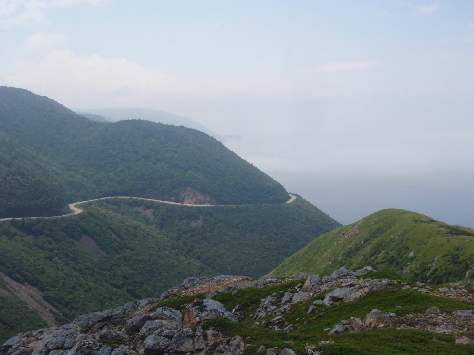
We climbed along a series of switchbacks to the top of French Mountain. Hannah and I stopped to hike a gorgeous trail called the Skyline. The trail stretched along a ridge and offered dramatic views of the Gulf coast. Whales, moose, and bear all are readily seen from the trail, although we only encountered a bobcat. The hike itself stretched for approximately 10 km and was the highpoint (pardon the pun) of the day.


We continued up the highway pausing at every viewpoint to admire the scenery before stopping for a picnic lunch at MacIntosh Brook. A short walk through an old growth hardwood forest brought us to a small waterfall.


We followed the Cabot Trail around to the east side of Cape Breton and began to travel south along the coast. Here the views were dramatically different. The road hugged the coastline about 20 to 30 meters above the water and offered impressive views of steep cliffs and the massive waves that crashed against pebbled beaches.


The weather began to close in on us so we stopped for the night. Hannah prepared me a delicious birthday dinner of soup, salad and hot chocolate.


Fact: A person is only as honest as the firewood they sell you is dry.


The wood we purchased from the general store up the highway wasn’t quite as dry as their sign led us to believe. We eventually got our campfire going, using our air mattress pump like a bellow, and enjoyed a nice evening staring into the flames, eating marshmallows and waving smoke away from our faces. RABBITS RABBITS RABBITS! All in all, a great day and an awesome way to spend one’s birthday!


July 20, 2011 (Cape Breton Day 2)


Forecast was for sunshine all day. We were pretty sure it was sunny above the layer of fog that had enveloped us. Walked up to the pay phone as there was sketchy cell service and booked the ferry to Newfoundland in anticipation of tomorrow’s journey. Later we went of to explore more of the park. Our first stop was at the trail head of a hike to Middle Head. The hike itself could best be described as undulating. Walking through fog, we hiked up and caught glimpses of the shoreline and the Atlantic. We hiked down through windblown bush and wildflowers. When we arrived at the point, we were impressed with the size of the waves crashing below us. Gulls and other sea birds wheeled high above us while others nested in rookeries beneath the cliffs. Unfortunately, the fog was again keeping us from seeing the park in its full glory.


We drove back through the park, retracing some of yesterday’s route. The hope was the fog would lift and we would get to see more than we had yesterday. Along the way, Hannah spotted some whales from the car. We stopped at the next viewpoint and managed to see the tail of another as it dove to feed. The whales were probably fin whales, although humpbacks also frequent this part of Cape Breton.

Continuing north, we stopped at a little outpost called Neil’s Harbour. It is the quintessential maritime fishing village. Fish boats bobbing at anchor, lobster traps stacked in anticipation of another opening, and a small fish packing plant tucked away against the shoreline.


We stopped for a picnic lunch at Neil’s Brook. A small creek feeds a freshwater lake that terminates against a large sand dune. On the other side of the dune, ocean waves rolled up lazily onto the sandy beach. We met a couple from outside of Toronto and exchanged stories of our Cape Breton experiences before heading back to our campsite at Broad Cove.


The mosquitoes were quite bad in our campsite so we went down to the beach where the onshore breeze tended to keep them at bay. Hannah skipped stones across another freshwater lake and later we crossed the dunes and watched an angler casting out into the surf.


After a quick shower, we returned to a bench high above the beach and listened to the waves pound against the cliffs below. The fog returned more determined than ever, covering us with a fine mist as I worked on the blog and Hannah read a book and blew bubbles with her gum.

Newfoundland, our tenth province, will be our next stop.

Wednesday, July 6, 2011

Newfoundland (Gros Morne)

July 21, 2011: Nova Scotia to Newfoundland

A wicked storm rolled over the campsite last night around midnight. The wind came in gusts every two to three minutes and reminded me of the Arctic outflow winds that we often get on the west coast. Heavy rain followed for a couple of hours. By morning, the fog that had blanketed us for most of the last couple of days had blown away. We had a beautiful clear view of the coast as we made our way south to Sydney to catch the boat to Newfoundland.


Our ferry was a modern vessel, although it was quite a bit smaller than the largest class of ferries running between Vancouver Island and the mainland. There were large, comfortable, reclining seats in the rear lounge. Prominently displayed throughout the lounge were signs stating passengers are not allowed to sleep in the chairs. Within minutes of departure, a couple seated behind us were snoring blissfully.

At the front of the ship was a large bar complete with a Newfie folksinger bashing away on his amplified guitar. This was by far the most popular spot on the ship. We observed several bar patrons struggling to walk to the comfy seats in the stern. They, too, ignored the signs and were soon contributing to the symphony of snoring.


Our six hour cruise through thick Atlantic fog came to an end when we were unceremoniously deposited onto the “Rock” into a hellish rainstorm. Heavy ruts in the highway were filled with water and the car was hydroplaning. Transport trucks and tourists alike were driving far too fast for the conditions, and I just wanted to stop for a while in hopes the rain would cease. Unfortunately, there were few places to stop in Port aux Basques so we drove on, slowly, to Corner Brook. As dusk began to fall, my attention remained on the rain, but I was also starting to think about moose. Many people are killed in Newfoundland every year when their vehicles strike the animals. We arrived at Corner Brook, but there were no rooms available. I had decided that we would continue east to St John’s and try to get out of the weather system we were experiencing. On our return trip we would try again to get up to Gros Morne. We drove on to Deer Lake and again were unable to get a room. I asked if they had a stable. Our only option was to continue to our original destination, Gros Morne National Park. After a slow drive through rain and under threat of having a collision with a moose, we finally reached our campsite. Hannah and I moved as much of our camp equipment to the front seats and slept in the back of the car. It was just too dark and wet to even attempt to set up the tent. As it turned out, our campsite was filled with moose, and we even encountered one on our way to brush our teeth in the washroom.


July 22, 2011: Newfoundland


Stuck our heads out the car and were greeted by a beautiful, cloudless sky. Now we had decisions to make. Go north to L'Anse aux Meadows (where the Vikings landed) or go back an hour to the TransCanada and continue on towards St. John’s? We decided to travel up the northern peninsula. The drive was long, but words cannot describe the beauty of this place. Large fjords cut deep into the coastline and reminded me a lot of Norway.


Our small camera just could not capture the scope and size of it all. On our right ran the Long Range Mountains and on our left the Gulf of St. Lawrence. Across the water, we could clearly see the shores of Quebec and Labrador. The coastline was dotted with small fishing villages (outports). Seabirds hovered in midair against the onshore breeze before plunging suddenly into the sea after a meal. People in this area spend their time either out on the water or in the bush harvesting timber. The highway was of excellent quality and seemed to stretch on forever.


We noticed little “grow-ops” in the most obscure places. Some were kilometers away from any habitation. Upon closer examination, the grow-ops were actually vegetable gardens. Individuals were growing potatoes and other root vegetables. Initially people had settled near the sea for obvious reasons, but the rocky soil was not conducive to growing food. When the highway came through, the locals squatted on sections of land on the shoulders of the road and grew their vegetables.


After climbing for a while, we found ourselves crossing a large plateau sandwiched between the sea and the mountains. Lakes, bogs, scrub and stunted trees dominated the taiga-like landscape. The area is an ecological reserve that stretched as far as the eye could see.

We arrived at L'Anse aux Meadows and the first thing that caught our attention were the enormous icebergs floating just off shore. They have to be some of the most beautiful things either of us have ever seen. Apparently, it has been a very good season for viewing icebergs, and we felt fortunate to have been able to see them on this trip so late into the summer.


We took the tour of L'Anse aux Meadows and learned about the history of the area. We saw where the Viking village was and were able to enter several sod buildings that Parks Canada had replicated. It was interesting to learn that the village was never meant to be a permanent settlement, but rather a repair and replenishment center. The Vikings used the area to forge iron nails and repair their boats. They lost several battles with the local aboriginals and apparently decided never to return.


The interesting thing about this place is that it is where east met west. The human race began in Africa and then spread east and west. L'Anse aux Meadows is the spot where Europeans first came into contact with people who had migrated west across the globe.

We ran into a retired couple of teachers from Campbell River who were doing the same trip that we were. They were even driving the same vehicle. We exchanged information about must-see sites and accommodation options before stopping at a Tim's in St. Anthony. We returned to Gros Morne and stopped at a different campsite on the ocean in a place called Shallow Bay. After dinner we wandered down to the beach and watched the sun slip behind the horizon. A close to excellent day!


July 23, 2011 Shallow Bay (Gros Morne) to Terra Nova National Park


Awoke to dark clouds and a sick child. Hannah woke with a bit of a cough and some congestion. We retraced our route from Thursday night as we left the park. The sun appeared as we neared Deer Park and kept us company all the way to Grand Falls Windsor. Our goal today was to get to a Hyundai dealer to get the car serviced. Discovered the dealership isn't open on Saturdays and all the campsites were full. Decided to drive up the highway to Gander. Checked the Hyundai dealership there and discovered they also don't work Saturdays. Stopped for lunch and then drove to Terra Nova National Park and took a campsite at Malady Head. We scouted out the perfect site and then went to register before driving out to a small town for some provisions. We returned to our campsite and started to set up our tent when we witnessed the third of three cars pull into the neighboring site. The stereo began to blast and cases of beer were offloaded from the vehicles. It became obvious that this was going to be Party Central so we proactively took the tent down and went back to the registration kiosk to get a new site. We got a new site, set up our tent, and then went back into town to explore the local beaches. Hannah and I enjoyed a long walk along a crescent-shaped beach at Sandy Cove. Cold, crystal-clear sea water lapped against the sand while children played along the shore. Tomorrow we plan to head to a small seaside town two hours south to visit a family friend.


July 24, 201: Port Rexton


Although the drive was short in comparison to some of our earlier drives, today's was particularly tedious. There were several stops to accommodate paving, but otherwise there was not a lot to break the monotony of dotted white lines and endless expanses of forest. We listened to the CBC for most of the trip. It is easy to see how important the CBC is in Newfoundland. The radio is a thread that connects every community.

We drove off the TransCanada to a little outport called Port Rexton to visit with Graham Hookey, an old friend and former principal of a school Jodi and I both worked at. Graham graciously invited us to come for a visit. He has semi-retired in order to return to Newfoundland to look after his elderly parents.


Hannah and I were able to experience Newfoundland hospitality at its finest! Upon arrival, we visited with Graham and his parents. Graham's father had left Newfoundland years ago to work on a lake freighter on the Great Lakes and, like most Newfoundlanders, has returned to his birthplace after retiring. Hannah enjoyed Graham's lunch of fried bologna and fresh bread with partridge berry and bake apple jams. Two helpings later, we were off to Bonavista (the closest point in Canada to England). There we were able to see whales and a puffin rookery out on a small rocky point.


The three of us went out for dinner and some theater in the nearby town of Trinity. We enjoyed a delicious dinner of fish and chips. After dinner, we went to watch a play about the history of the outports entitled, "The Marvelous Terrible Place". The production used traditional song and storytelling to convey the social history of the small isolated fishing communities that dotted the Newfoundland/Labrador coastline. We learned how difficult it was to live and about the sacrifices the men made who went to sea to fish, hunt or work on merchant ships, and the hardships the women who were left behind endured.


Having the opportunity to see the outports and listen to the stories about the loss of the cod stocks gives one a much better understanding of how the disappearance of fish has impacted life in Newfoundland. Imagine Ontario losing all its manufacturing, Saskatchewan its wheat crop, or B.C. its entire forest industry and you might have a better understanding of how the loss of the cod fishery has impacted the island. That being said, I think the relationship people in Newfoundland have with the sea is richer and more profound than can be found anywhere else in the country. Our night ended with an elaborate fireworks display to celebrate Port Rexton Day. The fireworks lit up the night sky and reflected off the sea. We picked the right time to visit!


July 25, 2011


Hannah and I woke up early in anticipation of Graham's arrival. This morning was magic! Blue sky, green shores and sunlight flashing off turquoise water set the stage for a beautiful day on the water. The contrast between land, sea and sky was fantastic.


We went out into Bonavista Bay in Graham's father's dory. The inshore fishery was open for a few days so all the locals were out trying to catch a few of the once plentiful cod. It was interesting to listen to the old-timers who had already returned from a morning of fishing as we were going out. All agreed the fishing was poor, probably because of the amount of bait fish in the water. Some were lucky to catch a few cod while most returned empty handed. More than one fisherman lamented, "We be eating chicken again tonight!"


We motored out of the arm and into the bay proper. Salt spray flew off the bow as the small boat cut through the chop. Soon we came across a humpback whale feeding deep inside a small bay. We cut the engine and drifted for awhile and waited for the whale to reverse course and come back to us. We could see and hear the whale exhaling as it prepared to dive. Once, twice, and then on the third breath the humpback arched its back and lifted its tail before sliding silently beneath the surface.


We tried our hand at jigging for cod. Hannah was quite concerned because she knew, if successful, she would be required to kiss the cod on the mouth and to eat her catch. It turns out mainlanders aren't very good fishermen. We didn't even manage a bite!


On our return to the dock, we spotted a large pod of dolphins cruising back and forth in front of the boat chasing down capelin. After tying up the boat, we returned to the house for lunch and said our goodbyes before heading off for St John's.


Once in St John's, we went to Signal Hill, a national historic site overlooking the city. This was the place where Marconi sent the first radio message across the Atlantic. The views of the harbour and ocean were spectacular.


We traveled into St John's to look for accommodation for the night. Due to the late hour, we were not optimistic; however, at the Information Center they have a list of hotels/rooms that were sitting vacant so the owners are motivated to rent them even at a reduced rate. Hannah and I got a full apartment (3 floors) for $100 cash right in the downtown area, which during the short six week tourist season, was a bargain!


Once settled, we were off to explore the city. We walked down to the waterfront and through the historic streets of old St John's. Great place for a pub crawl! Hannah and I settled for a frappuccino and a coffee at the Starbucks, sat out on a patio and watched ships come in and out of the harbour. A relaxing end to a very full day!


We have elected to take a ferry back to Nova Scotia from St John's rather than traveling back to Port Aux Basques on the TransCanada. We will be taking the overnighter from Argentia to North Sydney, Nova Scotia. Before heading to the ferry, we are going to take the car to a spa for some TLC, especially since we've already travelled over 12,000 km. We've booked a service before embarking on the return leg of our trip.